This survey was undertaken to identify the illegal infrastructure within the Jail Khal area. At the beginning of the survey, highly precise Ground Control Points (GCP) were collected for image Geo-rectification using the GNSS-RTK Method. After the control points of the study area were identified, the aerial imagery of the study area was collected. UAV Survey was carried out to acquire stereo images in the Study Area and was executed by the GMGI Solutions Ltd and Centre for Geoservices and Research (CGR)
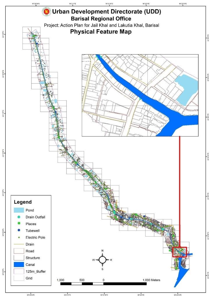
360 Panorama Photos of the study area were captured along with 4k video as per requirement. After the image acquisition, they were processed to create an orthophoto to digitize the physical features (Buildings, houses, industries, roads, water bodies, etc.). After the digitization of the features of the area, the shapefile was buffered accordingly to identify the infrastructure within that range.
After this step, the questionnaires for the physical feature survey and household survey were prepared via Kobo Toolbox. This concluded the field tasks. The collected data was then processed by ArcGIS and QGIS to produce land cover and land-use maps as instructed. All other associated deliverables were compiled along with the maps for submission.
The final task was to arrange workshops with Stakeholders to prepare an action plan.