-
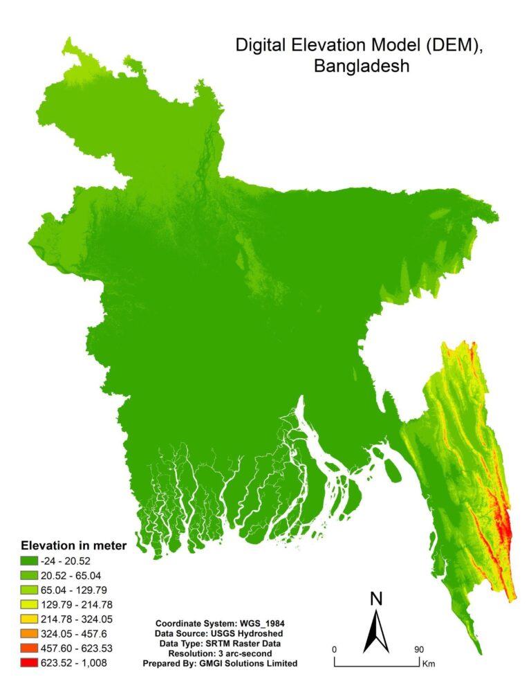
Making maps and 3D models of geographic features like rivers, mountains, and cities using GIS software and information from various sources like satellite imagery, aerial photography, and field surveys.
-
Offering assistance with large-scale spatial data management, storage, and organization.
-
Providing tools for accessing and analyzing the data
-
Hosting and maintaining GIS databases.
-
Utilizing GIS tools and methods to analyze spatial data and produce insights into geographic phenomena. This might entail studying data trends and patterns, projecting future trends, or simulating the effects of various scenarios.
-
Delivering consulting services to assist clients in comprehending and utilizing GIS technology and data in their operations or research. This could involve technical assistance, project planning, and training.